Zum Inhalt springen

Schlagwort: Maps

NearbyWiki

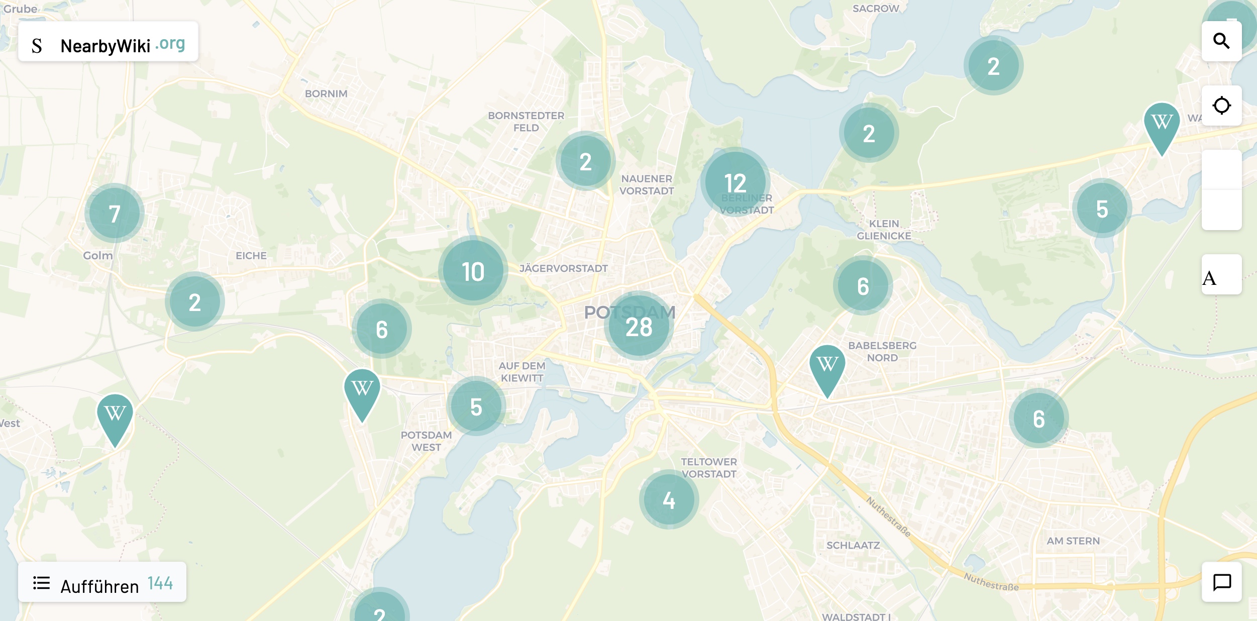
Ich habe mir über die Jahre angewöhnt, dass wenn ich in der Welt unterwegs bin, immer auf Wikipedia über die Orte zu lesen, in denen ich mich dann aufhalte. Man will ja wissen, mit wem man es zu tun hat. Klar. Da passt mir NearbyWiki sehr gut rein. Das nämlich ruft standortrelevante Wikipedia-Einträge ab, platziert sie auf einer Karte und zeigt interessante Fakten über die jeweilige Nachbarschaft, wie nahegelegene Sehenswürdigkeiten, Gebäude, bedeutende historische Ereignisse und so.
(via Book of Joe)

Ein Kommentar

Klänge der Wälder als Soundmap

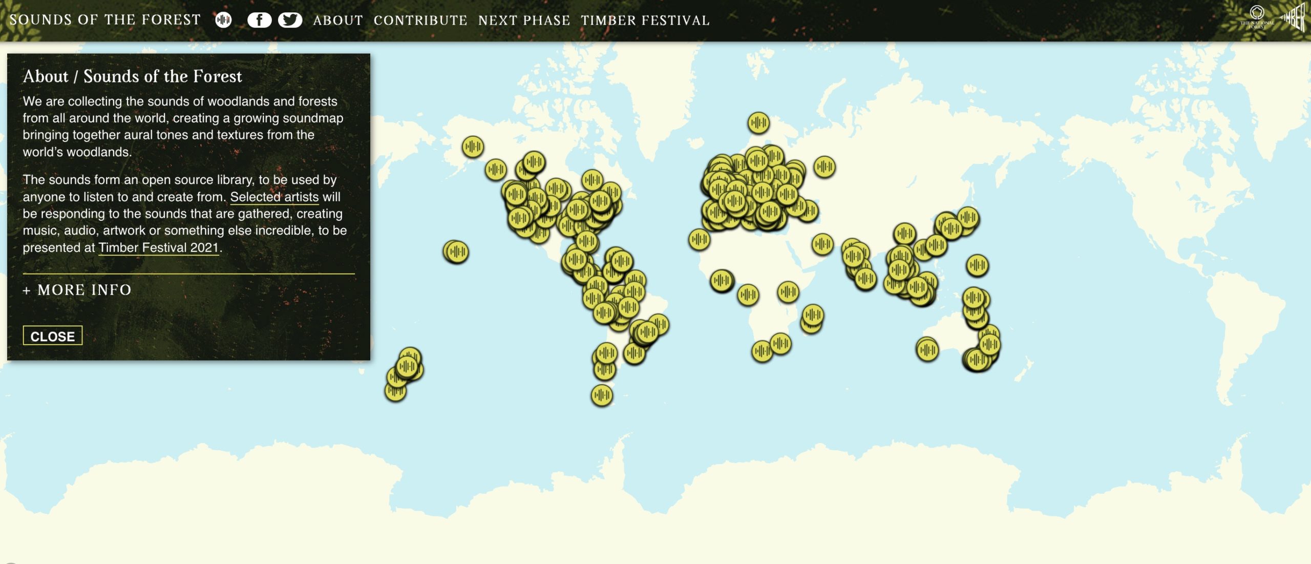
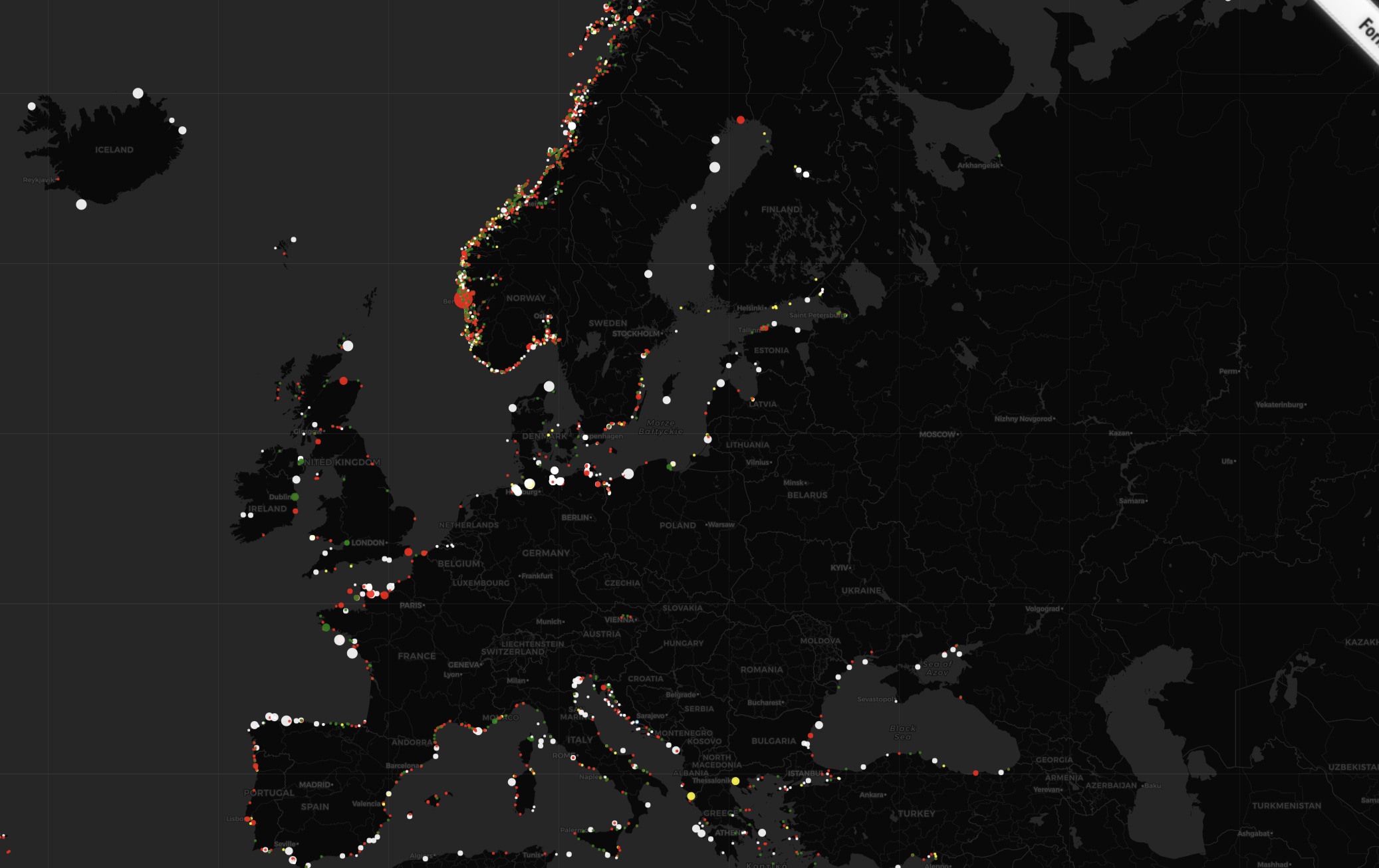
Schöne Idee für eine Open Source Soundmap: Sounds of the Forest sammelt auf einer internationalen Karte die Klänge der Wälder und man kann sich akustisch quasi in all die Wälder reinklicken. So als wäre man vor Ort.

We are collecting the sounds of woodlands and forests from all around the world, creating a growing soundmap bringing together aural tones and textures from the world’s woodlands.

The sounds form an open source library, to be used by anyone to listen to and create from. Selected artists will be responding to the sounds that are gathered, creating music, audio, artwork or something else incredible, to be presented at Timber Festival 2021.


(via BoingBoing)

Einen Kommentar hinterlassen

Interaktive Karte zeigt mittelalterliche Mordfälle in London, York, und Oxford

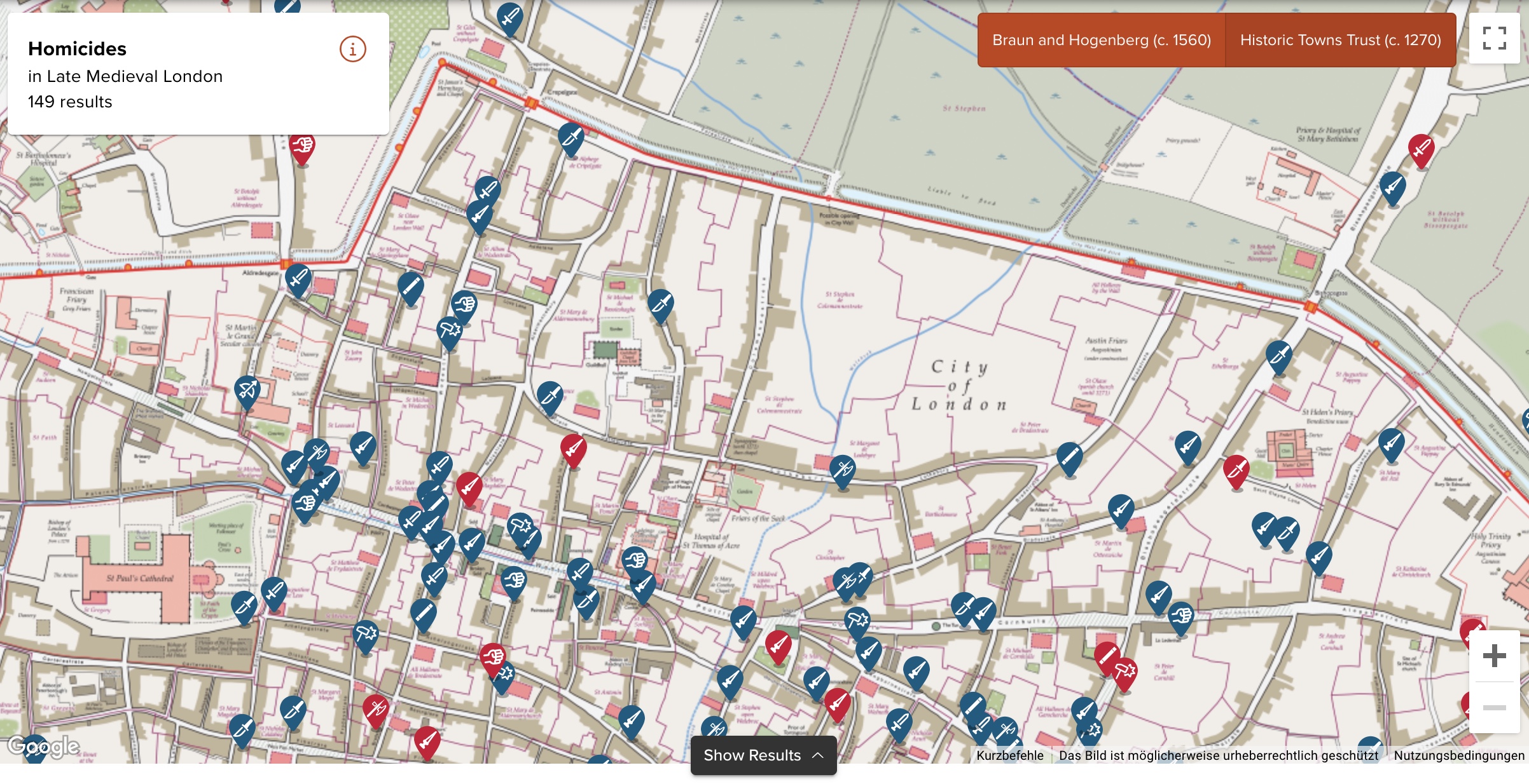
Die University of Cambridge hat eine interaktive Karte im Netz, die die im Mittelalter statt gefundenen Morde und dazugehörige Hintergrundinformationen in London, York, und Oxford zeigt. Ich weiß gar nicht, was genau die Karte für mich so interessant macht, aber ich klicke da jetzt trotzdem schon eine Weile drin rum.

In the first half of the fourteenth century, London was a bustling metropolis. The population of 80-100,000 people mostly lived within the City Walls, with 7 main gates, 25 wards, and about 110 parishes. Along the Thames, the wharfs and markets saw merchants from Flanders and the Hanse Cities, and the area around Poultry and Bank was home to a large financial industry with bankers from Florence and elsewhere. Markets around Bishopsgate, along Cheapside offered fish, meat, milk, bread and other daily goods. London was also famous for its luxury goods, especially gold, clothes, shoes, spices, weapons and jewellery. Powerful guilds such as the tailors, fishmongers, bakers, and cordwainers dominated local politics, controlled prices, and gave a sense of identity to young people as apprentices. Religious houses were scattered across the city, and St Paul’s Cathedral with its massive spire dominated the skyline.

London coroners’ rolls have survived for nine years between 1300 and 1340. The texts report the findings of the investigative jury. They were summoned when a suspicious, sudden and violent death had occurred. Although the details vary, the summary would usually specify where and when the homicide happened, who was involved, what triggered the event, what weapons were used, and what the nature and dimensions of the wound were.

(via MeFi)
Einen Kommentar hinterlassen

Ein Autonavigationssystem von 1973

Alles hat seine Geschichte. Auch Navis, wie wir sie heute kennen und gerne täglich nutzen, sind nicht irgendwann einfach mal so vom Himmel gefallen, um uns das Leben leichter zu machen. Und es gibt sie eh schon länger als TomTom, Google- und/oder Apple Maps. Versuche, den Leuten auf den Straßen das Navigieren zu erleichtern, gibt es schon sehr lange. Hier ein Einblick in die Idee eine Navis aus dem Jahr 1973. Da war ich noch nicht mal geboren, aber es dürfte wohl zu den Anfängen dessen zählen, was wir alle heute so alltäglich nutzen, als wäre es schon immer da gewesen. War es nicht. Wissen wir alle.


(Direktlink)

Einen Kommentar hinterlassen

Karte zeigt alle Orte, die man von einem ausgewählten Bahnhof direkt mit dem Zug erreichen kann

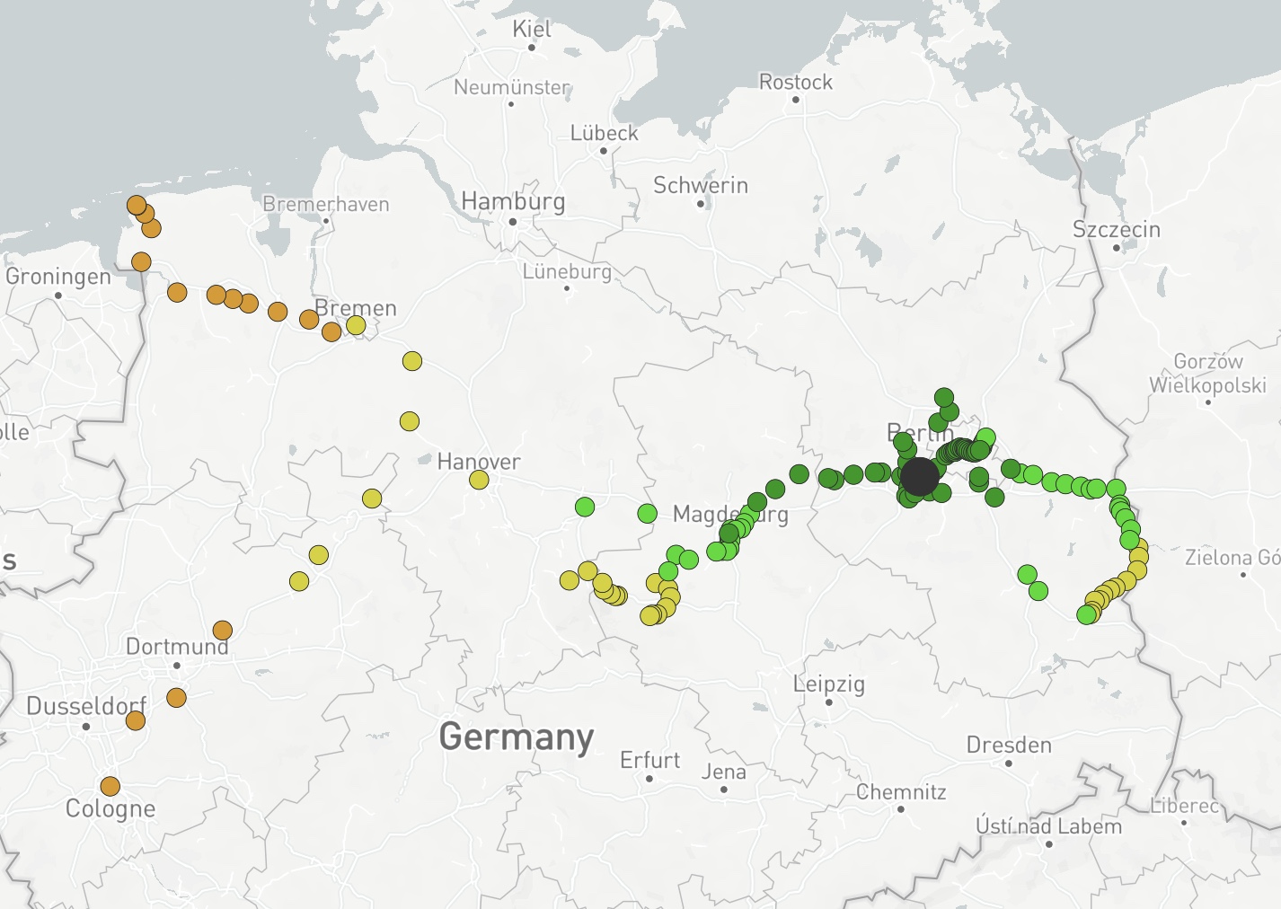
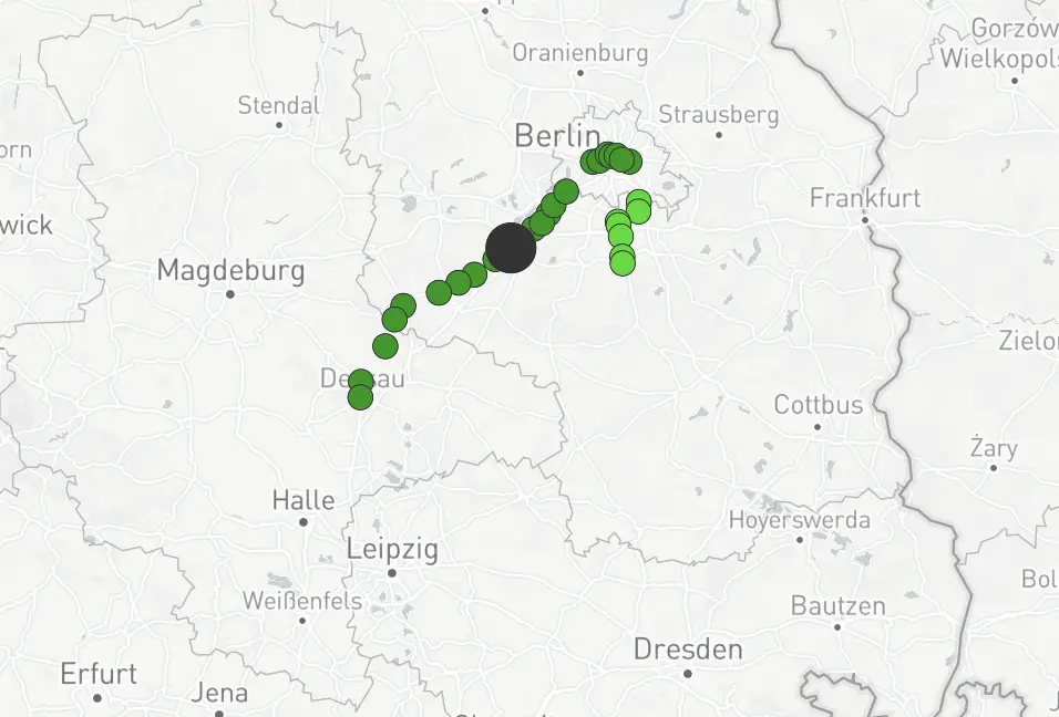
Kurzer und wie ich finde praktischer Reiseservice: auf direkt.bahn.guru kann man sich anzeigen lassen, welche Bahnverbindungen von einem ausgewählten Bahnhof direkt mit einem Zug benutzbar sind und an welches Ziel sie führen. Von Potsdam aus sähe das so aus. Da geht aus anderen Großstädten sicher mehr.

Aber ein anderer (Regional)Bahnhof, den ich mehrfach die Woche nutze, hat noch deutlich weniger zu bieten.


(via S@Kirst3nF)

8 Kommentare